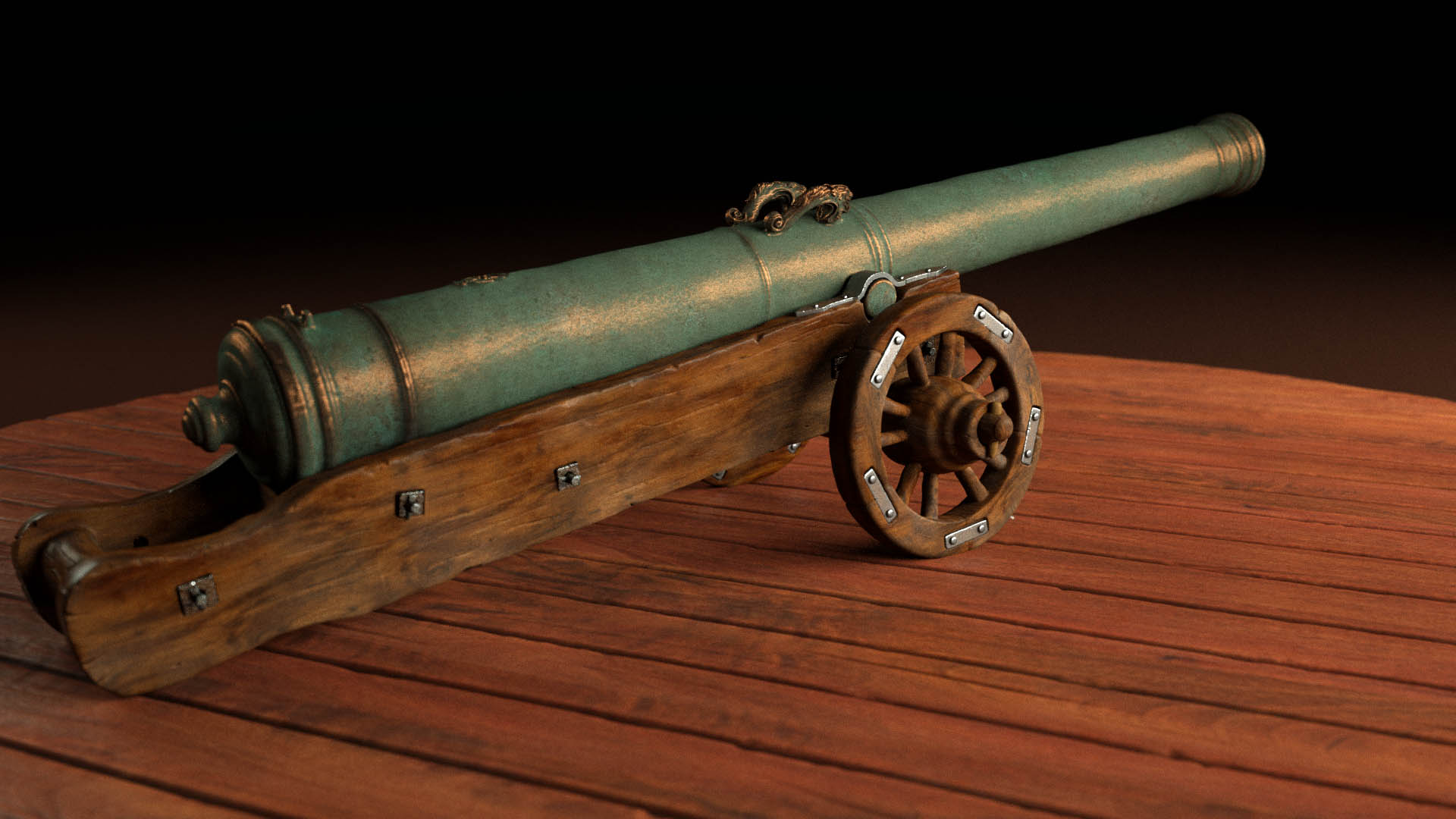
01 Visualization · Inspection
3D Scanning / Photogrammetry
High-resolution 3D scanning for wrecks, pipelines, bridge foundations, ports, tunnels, and other underwater infrastructure.
Ocean Discovery helps authorities, museums, universities, municipalities, and industry understand underwater environments with measurable data, fast deployment, and clear visual outputs.
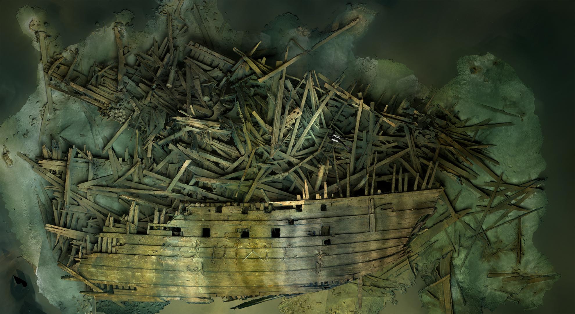
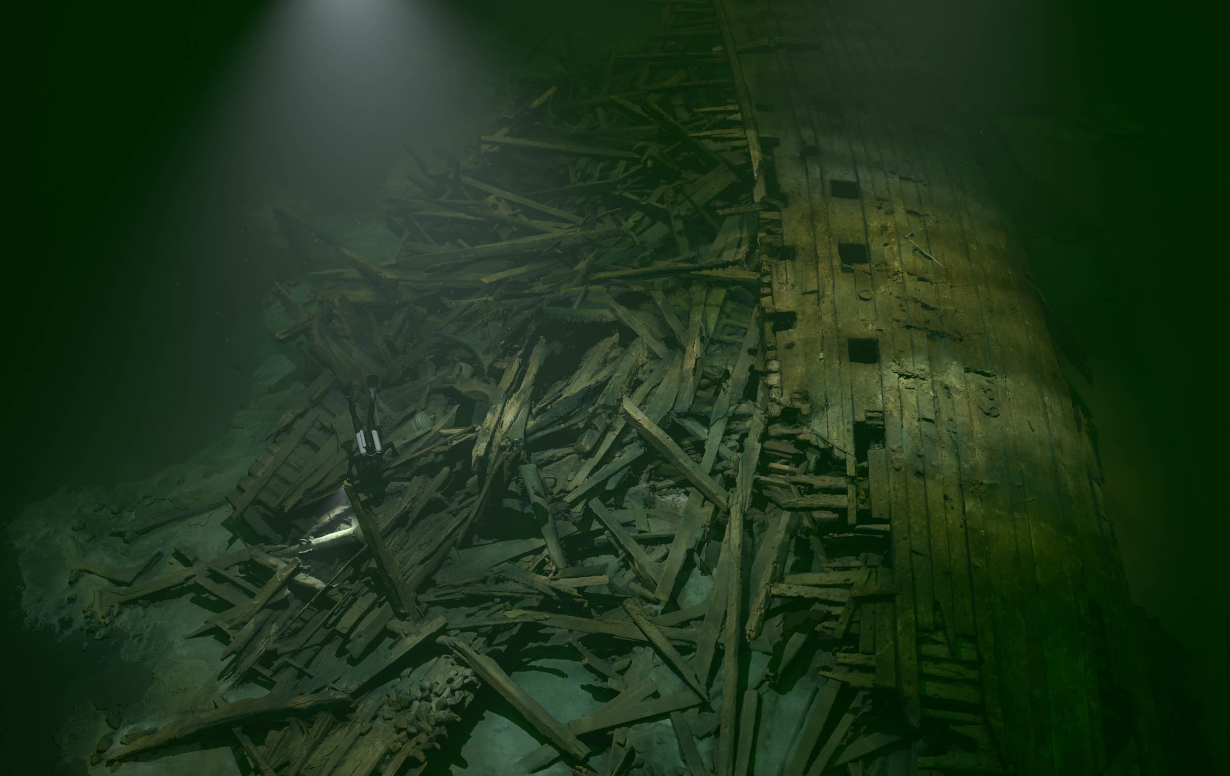
Baltic Sea · 2022 · SHK
— 01 / 04
Services
A focused service stack for underwater sites where precision, documentation, and interpretation matter.
High-resolution 3D scanning for wrecks, pipelines, bridge foundations, ports, tunnels, and other underwater infrastructure.
Archaeological 3D mapping and investigation of shipwrecks, maritime remains, and sensitive cultural heritage sites.
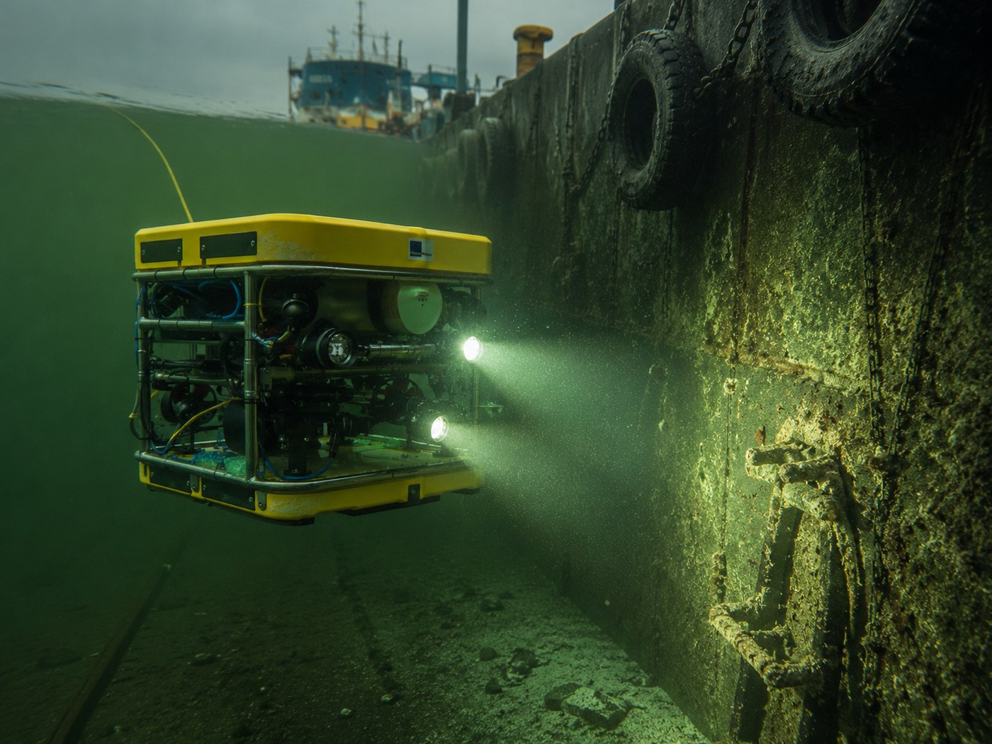
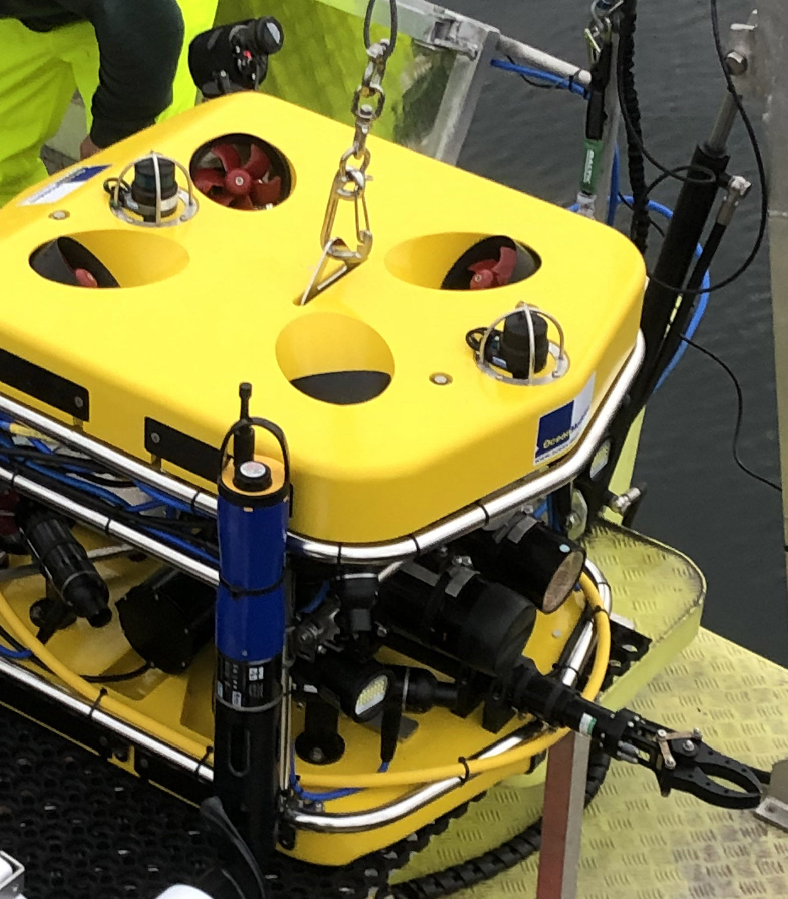
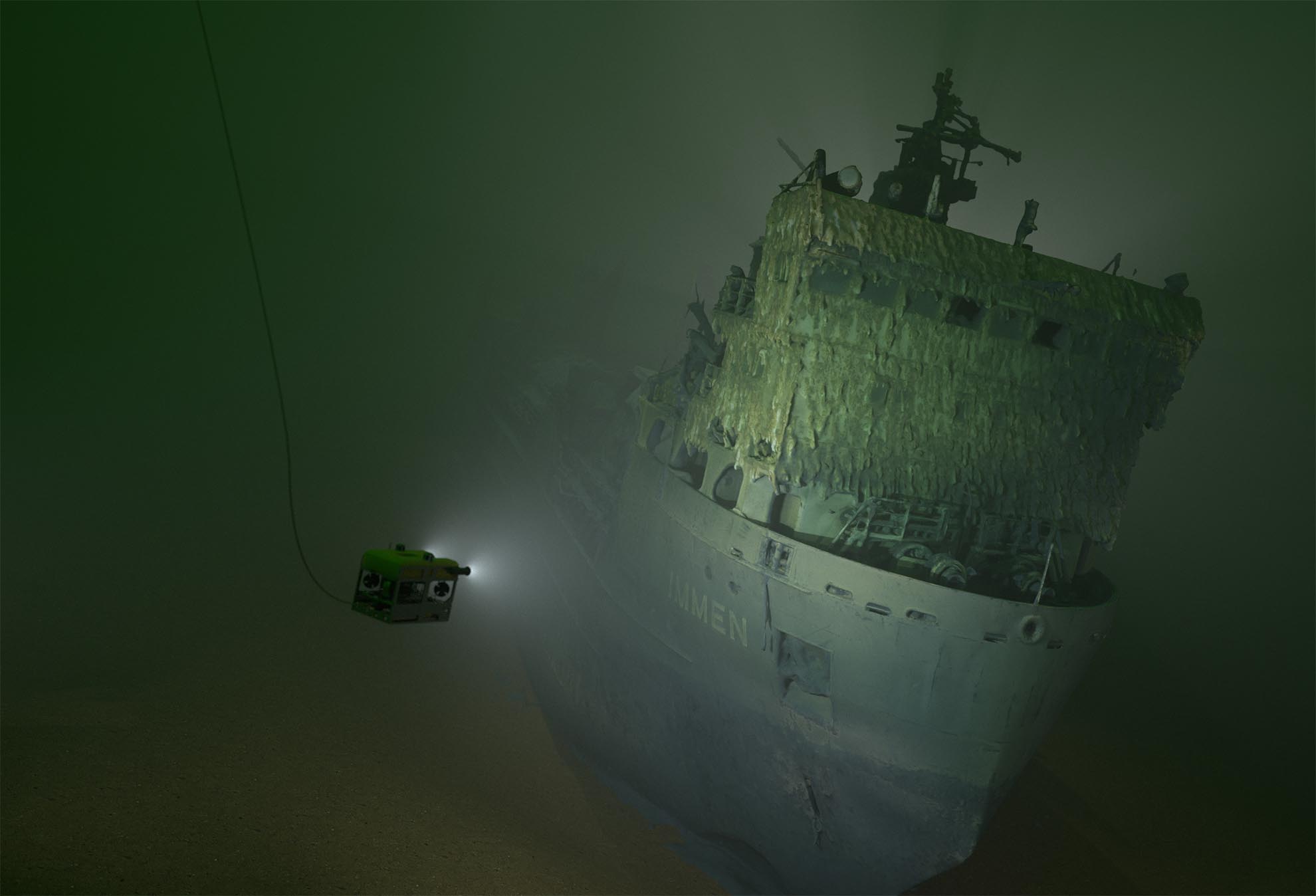
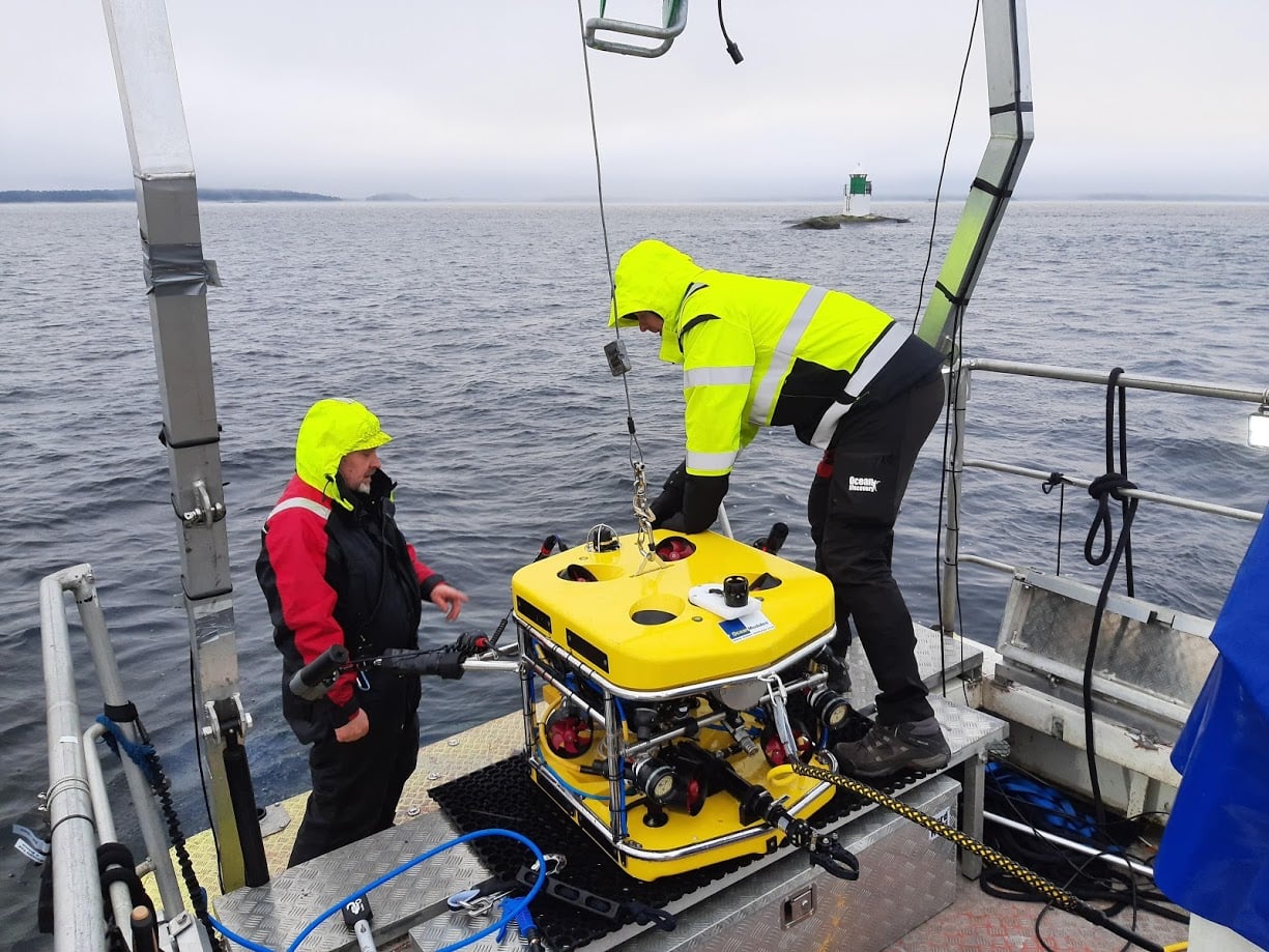
Advanced remote-operated vehicle inspections with video, ultra-high-resolution stills, underwater positioning, and real-time sonar.
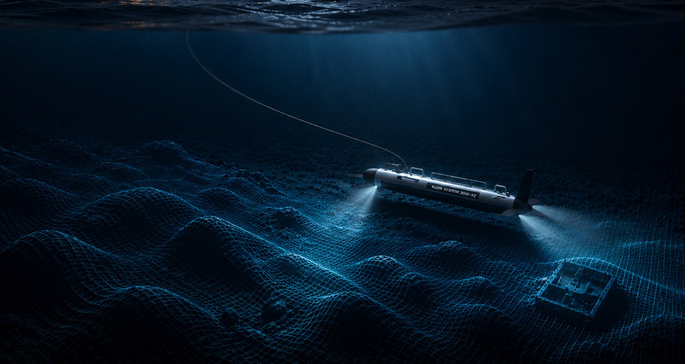
Efficient surveys for sea pipelines, harbours, wrecks, channels, and underwater objects.
Water analysis and ROV-supported hull or structure thickness measurement using ultrasound.
Visualizations, animations, digital restoration, 3D print preparation, app content, and VR-ready experiences.
— 02 / 04
Recent assignment
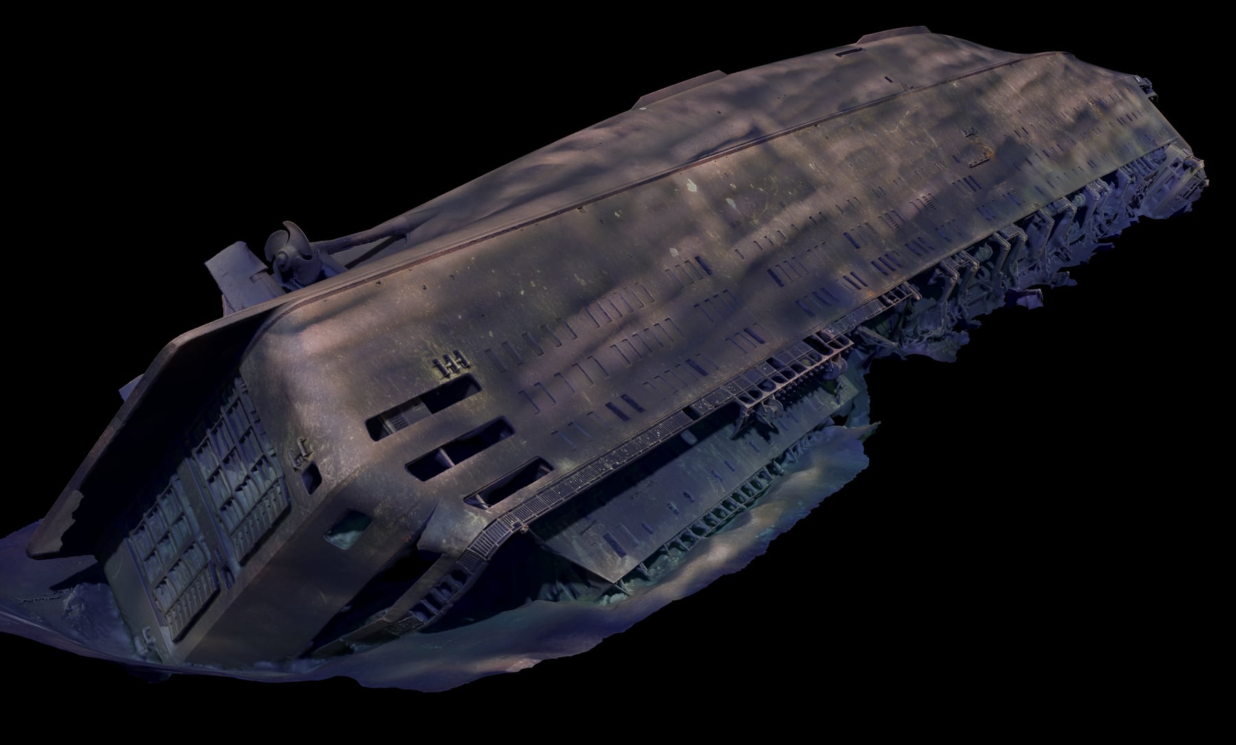
Ocean Discovery carried out the M/S Estonia photogrammetry assignment in 2022 as documentation for the Swedish Accident Investigation Authority.
Case study 01
In summer 2022 the wreck was documented with ROV and photogrammetry. The result was a detailed 3D model based on tens of thousands of images, produced for analysis, communication, and technical review.
— 03 / 04
Field experience
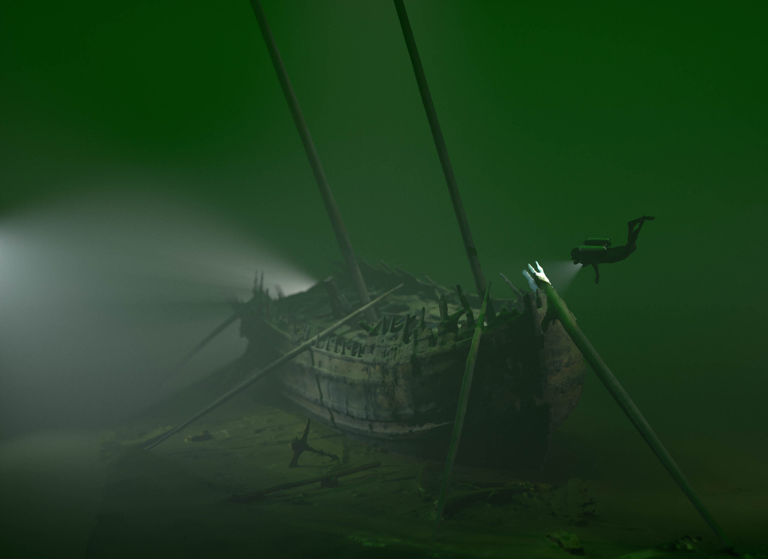
Ocean Discovery has contributed to major shipwreck discoveries and advanced documentation projects, from the Mars warship to the Swedish hazardous-wreck programme.
Founded as a diving company in Vastervik.
From sonar to VR-ready outputs.
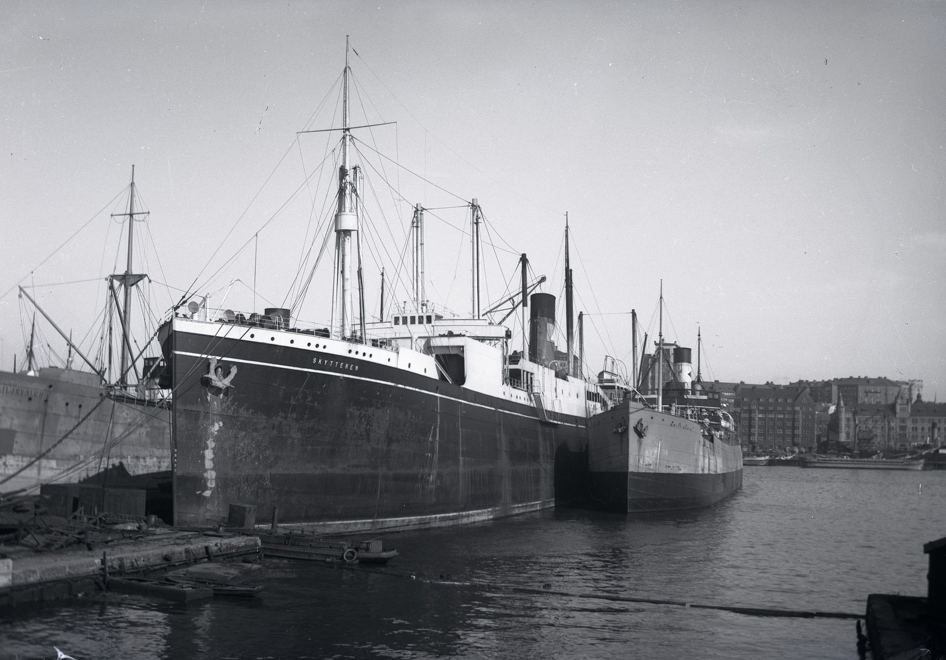
Measurable point-cloud density on Skytteren model.
LAS, E57, OBJ, FBX, glTF, STL.
— 04 / 04
Previous projects
A selection from Ocean Discovery’s earlier news and projects: hazardous wrecks, marine archaeology, EIVA point clouds, ROV inspections, and visualizations.
Photogrammetric documentation of M/S Estonia for the Swedish Accident Investigation Authority's preliminary assessment.
3D documentation of one of Sweden's highest-risk wrecks, located northwest of Gothenburg.
Marine archaeological 3D documentation of the famous warship Mars, which sank off Öland in 1564.
Documentation and 3D scanning of Nynäs, Harburg, and Mundogas for the Swedish Agency for Marine and Water Management.
Photogrammetric 3D documentation of the historical Bodekull wreck — one of the most detailed underwater scanning projects along the Swedish coast.
New ROV documentation of Kraveln, a ship from the era of Gustav Vasa in the Stockholm archipelago.
Process
Four steps, same rhythm since 1995. No black box — you see exactly what the team does and why.
01 · Define
We align on location, water conditions, risk, access, documentation needs, and decision criteria.
02 · Capture
ROV, sonar, photography, sampling, and measurement workflows are selected for the mission.
03 · Process
Raw capture becomes models, imagery, maps, measurements, and visualizations your team can use.
04 · Deliver
Final files are packaged for stakeholders, investigators, researchers, or public communication.
Next site question
Share the site, the challenge, and the output you need. Ocean Discovery AB is based in Vastervik, Sweden.