In June 2022, a photogrammetric documentation of M/S Estonia was carried out. Ocean Discovery performed the photogrammetry assignment, resulting in approximately 45,000 photographs and digital 3D material for the Swedish Accident Investigation Authority's preliminary assessment.
The mission was carried out under demanding conditions using ROV operations, positioned image capture, and photogrammetric processing. The image material was compiled into a 3D model that makes it possible to examine the wreck's exterior, structure, and technical characteristics without disturbing the site. The model supports analysis, visualization, and communication in one of Sweden's most significant maritime investigations.
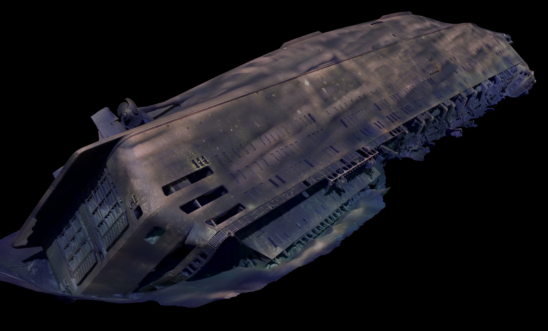
Photogrammetry for accident investigation
Photogrammetry uses large numbers of overlapping images to create a measurable 3D model. For the Estonia documentation, SHK states that approximately 45,000 photographs formed the basis for the model. The work gave investigators a digital basis for viewing and studying the ship's exterior condition.
Rendered 3D model from the bowOrthographic view of the wreckStern view from port side
ROV operation and control room
Data capture required stable ROV operation, a control room with multiple sensor and camera feeds, and careful planning of passes across the wreck. This workflow made it possible to collect visual material systematically despite limited visibility and difficult site conditions.
ROV control roomROV before documentation runLaunch from deck
Digital model and delivery
The digital model was created to provide as accurate an overview as possible of the ship's exterior and technical characteristics. The result could be used for visualization, review, and as input for a physical model and public presentations.
Port side in the 3D modelStarboard side in the 3D modelStern detail view
Offshore field logistics
The operation was carried out with vessel-based ROV equipment, a deck team, and a control room working in parallel. The images show parts of the practical mobilization: ROV on deck, support systems, launch operations, and work directly connected to the survey site.
ROV and support systemsROV launchService and preparation