Ocean Discovery turns photogrammetry and 3D scanning data into clear visual deliverables for museums, media, exhibitions, and technical communication. The aim is to make underwater environments understandable while preserving the measurable link to the original data.
CGI from measurable 3D models
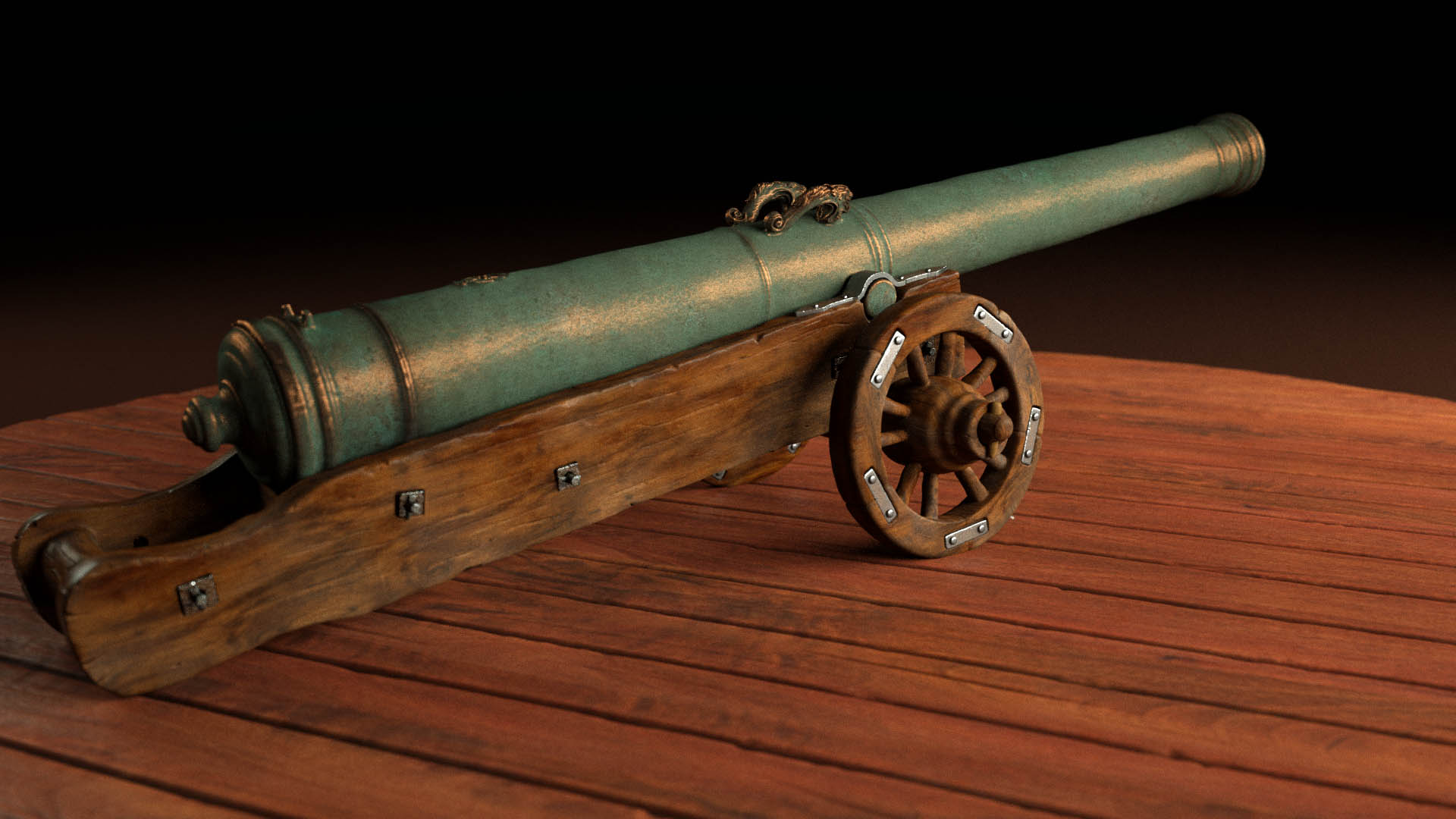
Underwater visibility is often limited to a few metres. With 3D scanning, the water can be removed digitally and the entire wreck site can be shown in one coherent view. Lighting, camera movement, and environment can be controlled to create a clear visualization without losing the technical foundation.
CGI from a 3D-scanned wreck modelPhotogrammetry as visualization baseMeasurable 3D model
Rendered video and animation
Image sequences and animations can be rendered into video for presentations, exhibitions, and documentary material. Digital divers, ROVs, or scale references can be added to make size, function, and site context easier to understand.
Animation source from wreck modelRenderable photogrammetry dataData collection for visualization
Digital restoration and public use
3D-scanned models can be used as a base for digital restoration, where damage, erosion, and corrosion are processed to show how an object or structure may have appeared. Deliverables can be adapted for web, exhibitions, film, print, VR, and 3D printing.
Digital restorationRestoration from scan dataPublic visualization